Chinatown

chinatown-history

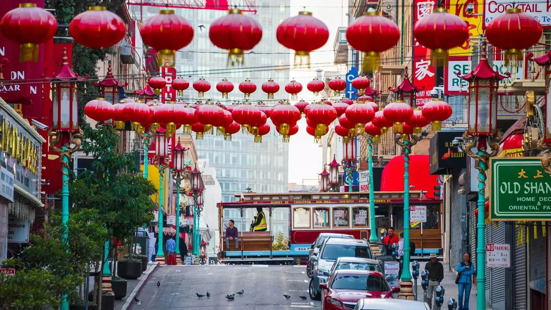
San Francisco’s Chinatown is the oldest in North America and one of the largest outside Asia. About 15,000 people live in roughly 30 square blocks, mostly in SRO hotels and walk-up apartments above the storefronts. The neighborhood has been the commercial and residential center of Chinese American life on the West Coast since the 1850s. … Read more

Financial District

9482891078_da4f930f1f_o

The Financial District is built on the filled-in Yerba Buena Cove, with Gold Rush ships still buried beneath the streets. It became the banking center of the West Coast after 1849.

Fisherman’s Wharf

92

Fisherman’s Wharf runs along the northern waterfront from Pier 39 west to Aquatic Park and Ghirardelli Square. Italian and Sicilian fishermen settled this stretch starting in the late 1800s, and a working commercial fishing fleet still docks at Pier 45. The boats head out before dawn for Dungeness crab, salmon, and sea bass that supply … Read more

Haight-Ashbury

legs on haight

Haight-Ashbury grew as a streetcar suburb in the 1880s and 1890s. Its Victorian flats and cheap postwar rents set the stage for the 1967 Summer of Love.

Hayes Valley

hayes valley

Hayes Valley is named for Thomas Hayes, who developed the area in the 1850s. Its current walkable form dates to the removal of the Central Freeway after the 1989 earthquake.

Japantown

Peace Pagoda (made of concrete)
Japantown
San Francisco, CA

Japantown is a small neighborhood in the Western Addition, centered on the Japan Center malls and the Peace Pagoda. It is one of three remaining Japantowns in the United States, along with those in Los Angeles and San Jose. The History Japanese immigrants began settling in this part of the Western Addition in the years … Read more

Marina District

Palace of Fine Arts at Night San Francisco

The Marina spreads along the northern waterfront. The land itself is mostly artificial. A cove was filled gradually from the late 1800s through the early 1910s, partly with rubble from the 1906 earthquake but mostly with sand and mud dredged from the bay. The large push happened around 1912 in preparation for the 1915 Panama-Pacific … Read more

Nob Hill

nobhill

Nob Hill is a residential and hotel district at the summit of the hill. Several of the city’s grand hotels are clustered here, on land that held the mansions of the late-19th-century railroad and silver magnates before the 1906 earthquake and fire destroyed most of those buildings. What to See & Do The Fairmont San … Read more

North Beach

columbus tower transamerica

North Beach is named for a beach that was filled in during the 19th century. It became San Francisco’s Little Italy and, in the 1950s, the center of the Beat movement.

Pacific Heights

1280px-Pacific-Heights

Pacific Heights developed as a wealthy residential district from the 1870s. Much of its early Victorian and Edwardian housing survived because the 1906 fire stopped at Van Ness Avenue.

Russian Hill

Lombard Street San Francisco Crooked Street

Russian Hill is a residential neighborhood on the hill north of Nob Hill, between Polk Street and the bay. Mostly known for Lombard St. Macondray Lane is a wooden staircase walkway between Leavenworth and Taylor Streets. Armistead Maupin used it as the model for Barbary Lane in his Tales of the City novels. Ferns, flowering … Read more

SoMa

soma

SoMa stands for South of Market. The neighborhood spreads across former industrial flats south of Market Street. Boundaries are not consistent; SoMa is often used as an umbrella for an area that includes Yerba Buena, the Western SoMa cultural corridor, and South Beach near Oracle Park. The blocks around Folsom and 9th Streets are the … Read more

The Castro

castro district

The Castro was farmland called Eureka Valley before becoming San Francisco’s gay neighborhood in the late 1960s and 1970s. Harvey Milk ran his campaigns from a camera shop on Castro Street.

The Embarcadero

San_Francisco_Ferry_Building

The Embarcadero is the waterfront promenade along the eastern edge of San Francisco, running from Fisherman’s Wharf to Oracle Park. The Embarcadero Freeway, a double-decker structure that had blocked the waterfront since the 1950s, was damaged in the 1989 Loma Prieta earthquake. Demolition started in February 1991 and ran through January 1992. The current promenade … Read more

The Richmond

image-1771085643

The Richmond is the residential grid west of Arguello and north of Golden Gate Park, running out to Ocean Beach. Fog is common here for much of the year. What to See & Do Golden Gate Park forms the southern border of the neighborhood. The western half of the park is generally quieter than the … Read more

The Sunset

1185px-San_Francisco_Sunset_District

The Sunset is the residential grid south of Golden Gate Park, running from Stanyan Street out to the Pacific. It is one of the largest residential neighborhoods in the city by area and population. The neighborhood splits roughly into the Inner Sunset (closer to the park, around 9th Avenue and Irving) and the Outer Sunset … Read more

The Tenderloin

image-1771085680

The Tenderloin is one of the densest neighborhoods in San Francisco. Depending on how the boundaries are drawn, 28,000 to 35,000 people live in roughly 50 square blocks, the majority in single-room-occupancy hotels built after the 1906 fire. The neighborhood remains working-class largely because of zoning protections won by community organizing in 1981. Developers proposed … Read more